


Homepage > Topographical Surveys

Topographical Surveys

Drone Surveys Dublin
Measured Building Surveys Dublin

10+

Years of Experience

Topographical Surveys

ACCURATE LAND MEASUREMENTS. DETAILED MAPPING. RELIABLE DATA.

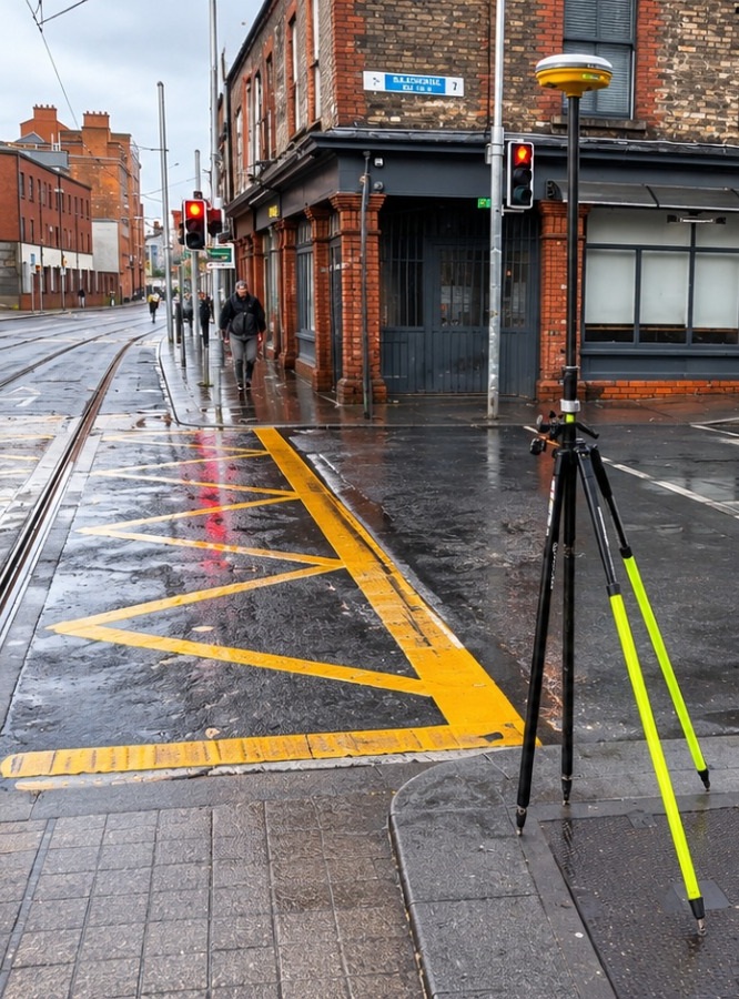
Digital Surveys provides professional topographical surveys, capturing accurate ground levels, terrain features and existing site conditions.

Using advanced surveying equipment and modern technology, we deliver detailed survey data and drawings to support architectural design, engineering and construction projects.

Our surveys provide a comprehensive overview of each site, identifying key features such as boundaries, access routes, drainage systems, utilities and surrounding structures. Every detail is carefully measured and documented to create a clear and accurate representation of the existing environment.

Whether supporting new developments, infrastructure improvements or land assessments, our topographical survey solutions provide a reliable foundation for informed decision-making. We tailor each survey to the specific requirements of the project, ensuring the information delivered is practical, precise and ready for use.

LET'S BRING YOUR PROJECT INTO FOCUS

DETAILED TOPOGRAPHICAL SURVEYS You Can Rely On

Accurate land information is essential for successful planning and development. At Digital Surveys, we provide comprehensive topographical surveys that capture ground levels, terrain variations, buildings, roads, vegetation and other existing site features.

Using modern surveying technology and professional expertise, we deliver precise measurements and detailed site plans, providing architects, engineers and developers with the reliable information they need to move projects forward with confidence.

Services

OUR TOPOGRAPHICAL SURVEY SERVICES

Land & Site Surveys

Detailed topographical surveys capturing existing ground features, terrain conditions, buildings and site infrastructure.

Land & Site Surveys

Levels & Contours

Accurate ground level measurements and contour mapping to illustrate terrain variations and site elevations.

Levels & Contours

Detail Surveys

Comprehensive mapping of existing site features, including roads, pathways, structures, drainage features and vegetation.

Detail Surveys

Drone Surveys

Advanced aerial surveying using drone technology to capture large areas and generate detailed mapping data and site imagery.

Drone Surveys

GNSS & Total Station Surveys

High-precision surveying using advanced GNSS and total station equipment to collect accurate positioning and measurement data.

GNSS & Total Station Surveys

Digital Terrain Models

Detailed digital representations of ground surfaces, supporting terrain analysis, engineering design and development planning.

Digital Terrain Models

What Our Clients Say

Trusted by Our Clients

We take pride in delivering accurate surveys, reliable data and professional service. But don’t just take our word for it — hear what our clients say about working with Digital Surveys.

“Digital Surveys provided an excellent service from start to finish. The team was professional, responsive and delivered highly accurate survey data within the agreed timeframe. Their attention to detail made the entire process smooth and straightforward. Highly recommended!”

John Murphy Dublin, Ireland

“We were very impressed with the quality of work and professionalism shown by Digital Surveys. Communication was excellent, the turnaround time was quick, and the final survey drawings were clear and detailed. A reliable team we would happily work with again.”

Michael O’Brien Cork, Ireland

why choose us

Precision, technology and expertise you can rely on.

4

Tailored Solutions

Professional surveying services adapted to the unique requirements of each project.

5

Reliable Service

Clear communication, attention to detail and a commitment to delivering quality results.

OurTeam

1

Precision & Accuracy

High-quality survey data captured using advanced surveying technology.

2

Advanced Technology

Modern 3D laser scanning, drone surveying and digital mapping solutions.

3

Comprehensive Deliverables

Detailed 2D CAD drawings, 3D point clouds, topographical plans and BIM models.

LET'S BRING YOUR PROJECT INTO FOCUS

NEED ACCURATE TOPOGRAPHICAL SURVEY INFORMATION?

Whether you are planning a new development, infrastructure project or site improvement, Digital Surveys provides accurate topographical survey data to support every stage of your project.

Get in touch with our team to discuss your surveying requirements and receive a tailored quotation.

Contact

Email

marius.fador@digitalsurveys.ie

Contact Us

Get in Touch with Our Team